Happisburgh Project, Norfolk
British Museum
Source - http://www.britishmuseum.org/research/research_projects/all_current_projects/featured_project_happisburgh/happisburgh_footprints.aspx

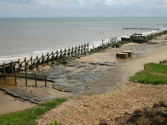
Photograph of Area A at Happisburgh from cliff top looking south © Martin Bates

Vertical image of Area A at Happisburgh with model of footprint surface produced from photogrammetric survey with enlarged photo of footprint 8 showing toe impressions © Happisburgh Project

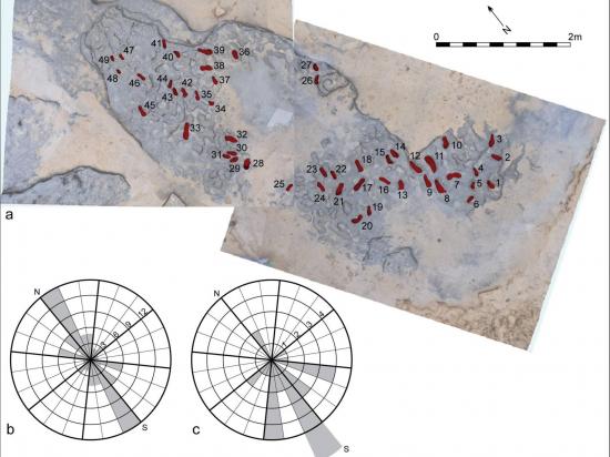
Analysis of footprints from Area A at Happisburgh: a. Model of footprint surface produced from photogrammetric survey showing the prints used in the analyses of footprint orientation and direction; b. Rose diagram showing orientation data for 49 prints; c. Rose diagram showing direction of movement for 29 prints © Happisburgh Project

Analysis of footprints from Area A at Happisburgh: a. Model of footprint surface generated from photogrammetric survey showing the 12 prints used in the metrical analyses offootprint size; b. Plot of length and width measurements of 12 prints showing possible individuals. Means and standard deviations for foot length and age for modern populations are also shown © Happisburgh Project

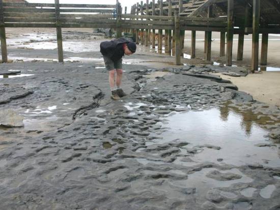
Photograph of the footprint hollows in situ on the beach as Happisburgh, Norfolk © Martin Bates

Reconstruction of Happisburgh, over 800,000 years ago© John Sibbick

Enhanced 3D model of footprint surface produced from photogrammetric survey by using colour to indicate depth © Happisburgh Project